 www.geodatenkatalog.de (S2L)
Keyword
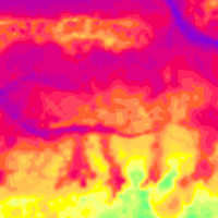
apparent resistivity
26 record(s)
Provided by
Type of resources
Available actions
Topics
Keywords
Contact for the resource
Service types
-
.png)
The WMS D-AERO (INSPIRE) comprises airborne geophysical surveys for mapping the shallow subsurface in Germany. Since the eighties BGR carries out helicopter borne measurements in Germany as well as in neighbouring and distant countries. In particular a series of continuous areas on the German North Sea coast are flown during the last years within the context of the D-AERO project. The helicopter of type Sikorsky S-76B is operated for the airborne geophysical survey of the earth's subsurface. Usually airborne electromagnetic, magnetic and radiometric measurements are carried out. According to the Data Specification on Geology (D2.8.II.4_v3.0, sub-theme Geophysics) the information with respect to the airborne geophysical surveys is INSPIRE-compliant. The WMS D-AERO (INSPIRE) contains for each airborne geophysical survey one layer, e.g. GE.flightLine.G081Cuxhaven. The flightlines are displayed correspondingly to the INSPIRE portrayal rules. Via the getFeatureInfo request, the user obtains the content of the INSPIRE attributes platformType und profileType. Additionally, the WMS contains a campaign layer (GE.airborneGeophysicalSurvey) with the INSPIRE attributes campaignType and surveyType.
-
Since the eighties BGR carries out helicopter borne measurements in Germany as well as in neighbouring and distant countries. In particular a series of continuous areas on the German North Sea coast are flown during the last years within the context of the D-AERO project. The helicopter of type Sikorsky S-76B is operated for the airborne geophysical survey of the earth's subsurface. Usually airborne electromagnetic, magnetic and radiometric measurements are carried out. The 13 GML files for each airborne geophysical survey area together with a Readme.txt file are provided in ZIP format (D-AERO-INSPIRE.zip). The Readme.text file (German/English) contains detailed information on the GML files content. Data transformation was proceeded by using the INSPIRE Solution Pack for FME according to the INSPIRE requirements of data specification Geology (D2.8.II.4_v3.0), Sub-theme Geophysics.
-
BGR conducted within the project „Airborne geophysical surveys for mapping the shallow subsurface in Germany “ (D-AERO) airborne surveys at the German North Sea coast. The survey area Langeoog (2008/09) comprises the island of Langeoog, the western portion of the island of Spiekeroog, the Wadden Sea to the south of the islands as well as an onshore stripe ranging from about Dornum in the west to Werdum in the east. The size of the area is about 259 km². The area was surveyed with 12 flights totalling to 1080 line-km (314,672 survey points). The nominal separation of the 68 N-S lines and 7 W-E tie lines was 250 m and 2000 m, respectively. The maps display the geophysical parameters apparent resistivity and centroid depth derived from the HEM data at the six frequencies of the HEM system (0.4 - 130 kHz). Furthermore, horizontal and vertical slices were derived from layered-earth models (resistivities and thicknesses of six model layers).
-
BGR conducted within the project „Airborne geophysical surveys for mapping the shallow subsurface in Germany “ (D-AERO) airborne surveys at the German North Sea coast. The survey area Esens (2008/09) ranges from about Dornum and Aurich in the west to Wittmund and Werdum in the east. The size of the area is about 370 km². The area was surveyed with 23 flights totalling to 1542 line-km (437,562 survey points). The nominal separation of the 75 N-S lines and 8 W-E tie lines was 250 m and 2000 m, respectively. The maps display the geophysical parameters apparent resistivity and centroid depth derived from the HEM data at the six frequencies of the HEM system (0.4 - 130 kHz). Furthermore, horizontal and vertical slices were derived from layered-earth models (resistivities and thicknesses of six model layers).
-
BGR conducted an airborne survey in the region of the Stassfurt-Egeln salt anticline as part of a BMBF research project "Dynamic processes in flooded or abandoned salt mines and their overburden”. The survey area Stassfurt (2007) is bounded by the towns and settlements Aschersleben, Kroppenstedt, Hadmersleben, Altenweddingen, Atzendorf, Förderstedt and Bernburg. The size of the area is about 467 km². The area was surveyed with 29 flights totalling 5137 line-km (1,344,787 survey points). The nominal separation of the 197 SE-NW lines and 39 NE-SW tie lines was 100 m and 1000 m, respectively. The maps display the geophysical parameters apparent resistivity and centroid depth derived from the HEM data at the six frequencies of the HEM system (0.4 - 133 kHz). Furthermore, horizontal and vertical slices were derived from layered-earth models (resistivities and thicknesses of four model layers).
-
This dataset has been compiled within the BGR project "D-AERO-Auswertung" based on several survey area located along the German North Sea coast. The BGR helicopter (Sikorsky S-76B) is used for airborne geophysical surveying of the Earth’s subsurface. The standard equipment comprises the methods electromagnetics, magnetics and radiometrics. The active multi-frequency, helicopter-borne electromagnetic (HEM) system, which consists of circular (diameter about 0.5 m) transmitter and receiver coils (horizontal separation about 8 m) operating at five and since 2007 at six system frequencies, is housed by a flying tube (bird) about 40 m beneath the helicopter. The HEM system used before 2002 consisted of rectangular coils (horizontal separation slightly less than 7 m) and five system frequencies (0.4 - 190 kHz). The ratio of received and transmitted signal yields to the electrical conductivity down to 50/150 m depth in case of conductive/resistive subsurface. Horizontal resistivity (= inverse of conductivity) sections are derived at several depths from multi-layer inversion results (1D resistivity-depth models).
-
This dataset has been compiled within the BGR project "D-AERO-Auswertung" based on several survey area located along the German North Sea coast. The BGR helicopter (Sikorsky S-76B) is used for airborne geophysical surveying of the Earth’s subsurface. The standard equipment comprises the methods electromagnetics, magnetics and radiometrics. The active multi-frequency, helicopter-borne electromagnetic (HEM) system, which consists of circular (diameter about 0.5 m) transmitter and receiver coils (horizontal separation about 8 m) operating at five and since 2007 at six system frequencies, is housed by a flying tube (bird) about 40 m beneath the helicopter. The HEM system used before 2002 consisted of rectangular coils (horizontal separation slightly less than 7 m) and five system frequencies (0.4 - 190 kHz). The ratio of received and transmitted signal yields to the electrical conductivity down to 50/150 m depth in case of conductive/resistive subsurface. The results are displayed as apparent resistivity (= half-space resistivity) and centroid depth maps at each of the six system frequencies ranging from 0.4 to 130 kHz.
-
BGR conducted within the project „Pilot study for a detailled airborne geophysical mapping“ (DAGLA) an airborne survey near the city of Cuxhaven. The survey area Cuxhaven (2001) is bounded by the city of Cuxhaven to the north, by the settlements Dorum and Neuenwalde to the south and Altenbruch to the east, and by the North Sea to the west. The size of the area is about 530 km². The area was surveyed with 18 flights totalling to 2427 line-km (615,403 survey points). The nominal separation of the 101 ESE-WNW lines and 32 NNE-SSW tie lines was 250/2250 m (on-shore/off-shore) and 1000/500 m (on-shore/off-shore), respectively. The maps display the geophysical parameters apparent resistivity and centroid depth derived from the HEM data at the five frequencies of the HEM system (0.4 - 190 kHz). Furthermore, horizontal and vertical slices were derived from layered-earth models (resistivities and thicknesses of six model layers).
-
The BGR helicopter (Sikorsky S-76B) is used for airborne geophysical surveying of the Earth’s subsurface. The standard equipment comprises the methods electromagnetics, magnetics and radiometrics. The active multi-frequency, helicopter-borne electromagnetic (HEM) system consists of circular (diameter about 0.5 m) transmitter and receiver coils (horizontal separation about 8 m) housed by a flying tube (bird) about 40 m beneath the helicopter. The HEM system used before 2002 consisted of rectangular coils (horizontal separation slightly less than 7 m) and five system frequencies (0.4 - 190 kHz). The ratio of received and transmitted signal yields to the electrical conductivity down to 50/150 m depth in case of conductive/resistive subsurface.
-
BGR conducted in 2013-2016 the research project "ErzExploration Erzgebirge E³" together with the Helmholtz Institute Freiberg for Resource Technology (HIF) at Helmholtz-Zentrum Dresden-Rossendorf (HZDR) and the Technical University Bergakademie Freiberg (TUBAF) to explore mineral resources in the vicinity of the city of Geyer, Erzgebirge. The size of the area is about 135 km². The area was surveyed with 16 flights totalling to 1653 line-km (418,603 survey points). The nominal separation of the 189 NW-SE lines and 14 SE-NW tie lines was 100 m and 500 m, respectively. The maps display the geophysical parameters apparent resistivity and centroid depth derived from the HEM data at the six frequencies of the HEM system (0.4 - 130 kHz). Furthermore, horizontal and vertical slices were derived from layered-earth models (resistivities and thicknesses of 20 model layers).